20 Best Tips

Learning About New Zealand ~ the Land of Kiwi

New Zealand was a stop we took in our geography travels after learning about Australia. New Zealand has two main islands and is in the South Pacific Ocean. We spent time learning about the many meanings of the word ‘kiwi’, the culture of the Maori people, how the flag was created; read/learned about sheep, talked about Sir Edmund Hillary and even learned a little about the sport of rugby.

Week 1 Layout

Monday

  • Introduce new song about New Zealand from Geography Songs
  • Use atlas and globe to locate New Zealand
  • Talked about the size of New Zealand  and that New Zealand is called the ‘land of the long white cloud’

  Tuesday

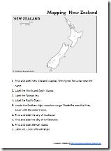
map of New Zealand

 Click on thumbnail to download pdf file

Wednesday

Thursday

Week 2 Layout

Monday

  • Review geography song
  • Watched a video about Maori warriors on You Tube {see below for video clip and link}
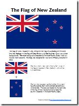
  • Learned about the flag of New Zealand

flag of New Zealand

Click on thumbnail to download pdf file


Tuesday

  • Review geography song
  • Learned about Sir Edmund Hillary ~ from New Zealand and climbed Mt. Everest
  • Talked about rugby and the All Blacks team
  • Completed some sheets about Sir Edmund Hillary {see links below}

Wednesday

  • Review geography song
  • Visited Time for Kids ~ New Zealand 
  • Talked about the three different meanings of the word ‘kiwi’ ~ fruit, bird and nickname of people from New Zealand
  • Ate some kiwi :)
  • Drew a picture of a kiwi bird

Thursday

  • Review geography song
  • Summarize one of our reading books and copy summary/dication
  • Added our notebooking pages to our binder and stamped our passports!

Books We’re Using

Resources and Websites

Traveling Tanzania

Tanzania wasn’t on the list of countries for Galloping the Globe, but I was asked to help write a preschool unit for Itty Bitty Bookworm and I couldn’t pass up all the research that I had done for the unit!

We studied about Tanzania after we finished up our unit on Kenya since they are both in eastern Africa. Tanzania is the largest country in East Africa and also has the tallest mountain ~ Mt. Kilimanjaro. For our study we started with the book We All Went on Safari by Laurie Krebs looked more at the Maasai culture, learned about Mt. Kilimanjaro, tried to speak a little Swahili, and just had fun exploring a little more of Africa!

Week 1 Layout

    Monday

    • Introduce East Africa song about Tanzania from Geography Songs {see words below}
    • Use atlas and globe to locate Tanzania
    • Independent reading ~ pick a book from the shelf to read 
    • Watched this 10 minute YouTube video about Tanzania


Tuesday

    • Review geography song
    • Learn {and reviewed} some geography terms: Mt. Kilimanjaro, Great Rift Valley, lake, crater, and island {Zanzibar}
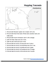
    • Completed our mapping activity of Tanzania

      mapping tanzania thumbnail Click on thumbnail to download pdf file

Wednesday

    • Review geography song
    • Built a Masai hut {which I cannot for the life of me find a picture of}. Laurianna gathered sticks/twigs from outside and glued them around a small can of chilies and it was very cute!
    • Learned about Mt. Kilimanjaro
    • Independent reading

Thursday

    • Review geography song
    • Story from Around the World in 80 Tales ~ The Dancing Hyena
    • Talked about similarities/differences between our culture and life in Tanzania
    • Reading together book on Tanzania {from our bookshelf}

Week 2 Layout

Monday

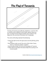
Flag of Tanzania GTG

Thursday

Resources and Websites

Books We Used

On Safari in Kenya ~ Our Lesson Plans

Our travels to the Eastern coast of Africa started with Kenya. We learned all about the Great Rift Valley and the heights of Mt. Kilimanjaro, figured out how to sing the chorus of Jesus Loves Me in Swahili, drew lots of fun pictures of safari animals, put together a fun diorama of a savannah, read some great books together, and visited some great websites to learn more about the great country.

    Week 1 Layout

    Monday

    • Introduce East Africa song about Kenya from Geography Songs
    • Use atlas and globe to locate Kenya
    • Talked about the size of Kenya 
    • Independent reading ~ pick a book from the shelf to read

    Tuesday

    • Review geography song
    • Learned {and reviewed} some geography terms: lake and valley, highlands, lowlands, equator,  and savannah
    • Learned about the Great Rift Valley and Mt. Kenya
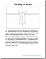
    • Learned about the flag of Kenya using our notebooking page

Flag of Kenya thumbnail

     Click on thumbnail to download pdf file

    Wednesday

    • Review geography song
    • Talked about the climate of Kenya ~ on both sides of the equator, wet and dry seasons, snow on top of Mt. Kenya
    • Visited National Geographic for Kids: Kenya site
    • Independent reading

    Thursday

    • Review geography song
    • Tried to sing Jesus Loves Me in Swahili ~ well, the chorus at least!

Yes, Jesus loves me. Yesu amipenda
Yay-soo ah-nee pen-dah [3x]
The Bible tells me so. Biblia ani sema
Bee-blee-ah ah-nee she-mah

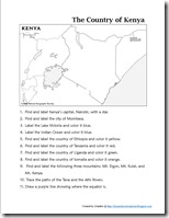
Mapping Kenya  Click on thumbnail to download pdf file

    Tuesday

    Wednesday

    • Review geography song
    • Used Draw Write Now to draw a lion and a cheetah
    • Learned about the baobab tree ~ the one that looks like it is planted upside down!
    • Independent reading

    Thursday

    • Review geography song
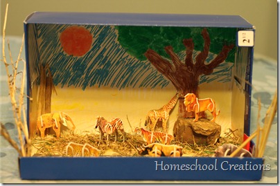
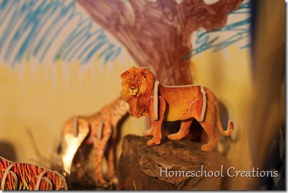
    • Laurianna worked on a fun diorama project of a savannah. We found some great 3D animal punch outs that she put together and then made up a ‘habitat’ for them

African Savannah diorama Africa diorama

    • Added our notebooking pages to our binder and stamped our passports!

Resources and Websites

Books We Used

Australia ~ Our Studies of the Land Down Under

We took two weeks to study the continent of Australia ~ and since I’m already behind in my geography posting, this post will have both weeks of our lesson plan layouts in it. Our first week we focused more on geography, currency, the Australian  flag, etc.. and during our second week learned about kangaroos, koalas, did lots of drawing, took some virtual tours and completed some minit books for our notebook. Here’s a peek at our studies:

Week 1 Layout
 

Monday

  • Introduce new song about Australia from Geography Songs 
  • Use atlas and globe to locate Australia
  • Talked about the size of Australia {slightly smaller than the US}
  • Independent reading ~ the girls spent this week reading Destination Australia together each day

Tuesday

  • Review geography song
  • Learn {and reviewed} some geography terms: coral reef, desert, rain forest, island, & also about Ayers Rock
  • Fun saying some Australian slang words
  • Learned about the flag of Australia using our notebooking page
Australian flag thumbnail Click on thumbnail to download pdf file

Wednesday

Thursday

Week 2 Layout

Monday

  • Review geography song
  • Looked at the Australia for Kids slideshow
  • Independent reading {McKenna ~ Dingoes at Dinnertime}
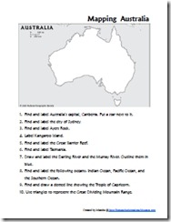
  • Completed our mapping activity of Australia
Mapping Australia thumbnail Click on thumbnail to download pdf file

Tuesday

  • Review geography song
  • Took a little tour via the site Time for Kids – Australia
  • Learned about animals that are unique to Australia: platypus, kangaroo and koala were the ones we focused on
  • Used Draw Write Now to draw a koala bear {Book 7}
  • Independent reading

Wednesday

  • Review geography song
  • Used Draw Write Now to draw a kangaroo {Book 7}
  • Worked on our minit books about kangaroos {from Homeschool Share}. We put these books on a sheet of cardstock and added them to our geography notebook. Minit books we focused on: kangaroo facts, kangaroo family, all about pouches, kangaroo matchbooks, kangaroo habitat, birth and care of joey, kangaroo diet
  • Independent reading

Thursday

  • Review geography song
  • Watched a video on the Sydney Opera House
  • Drew our own maps of Australia using Draw Write Now as a guide
  • Summarize independent reading book and copy summary/dication
  • Added our notebooking pages to our binder and stamped our passports!

Books We Used

 
Resources and Websites


Where We Are in Our Travel Studies

You may have noticed that I haven’t been posting about our geography studies. We have still been doing them, I’ve just been doing so much else that it got put on a back burner for a bit.

If you are following behind me, I’ll be posting in the next few weeks/month about the rest of our studies in Africa ~ Kenya, Morocco, South Africa and Tanzania. Right now we’re learning about Australia, so stay tuned!

In case you haven’t visited it yet, be sure to check out my geography pages on my website. Eventually all of my printables will be hosted there ~ and they are nicely sorted by continent and country for you all. Here are the links:

Main Geography Page ~ You’ll find my weekly planning pages here as well as some notebooking pages, flag matching cards, and links to the various continents we’ve studied: Europe, Asia, and Africa.

Links for the other continents will go active as soon as we ‘travel’ there!

Olde World Style Maps {Review}

image

After opening the first set of world map files from Home School in the Woods, the one thought running through my mind was “It would have been so nice to have had these two years ago when we started our geography studies.”

{sigh}

They are that lovely. And well done.

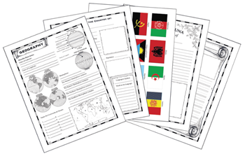
geography maps and notebookingOlde World Style Maps {for US & the World} are hand illustrated maps with an ‘old fashioned’ flavor ~ they look older and are very well done. The World Maps set {$18.95} offers maps from both the ancient world and modern day. You can print the maps with all of the information or blank, so that your child can fill in the information. Modern maps feature political lines while older maps have a physical map format. As a bonus, the Old World Style Modern and Ancient Maps: World Maps also includes 40 notebooking pages {fact sheets, information sheets, etc…} along with flag clip art and country clip art {see a sample of the world maps here}.

The United States Maps set {$18.95} includes maps for each state as well as DC and other American History maps. Like the World Maps, you can print them off with all the information or blank and ready to fill in and color. The Olde World Style Modern and Historical Maps: United States Maps set also includes bonus notebooking sheets for each state along with clip art for each state flag {see a sample of the US maps here}.

My Thoughts

After seeing the quality of these maps, I started browsing the Home School in the Woods website and managed to get myself a little distracted with some of their Time Travelers History Study Series.  Next year we’ll be studying Early American History and the unit studies that they offer make me want to learn more! Take a look at their Colonial Life pack and also the American Revolution pack. They include a ton of hands on projects that look amazingly fun ~ something we always like to have while learning!

To Purchase

Old World Style Maps are available as pdf downloads from the Home School in the Woods website. You can purchase either set for $18.95 each or as a combo for $28.95. If you prefer cd-roms, you can also purchase them on cds.

This product was given to me for review purposes, and I do not have to return the product to the vendor. I was not paid for this post. All opinions expressed in this post are mine.

Photobucket