
- Like
- Digg
- Del
- Tumblr
- VKontakte
- Buffer
- Love This
- Odnoklassniki
- Meneame
- Blogger
- Amazon
- Yahoo Mail
- Gmail
- AOL
- Newsvine
- HackerNews
- Evernote
- MySpace
- Mail.ru
- Viadeo
- Line
- Comments
- Yummly
- SMS
- Viber
- Telegram
- Subscribe
- Skype
- Facebook Messenger
- Kakao
- LiveJournal
- Yammer
- Edgar
- Fintel
- Mix
- Instapaper
- Copy Link
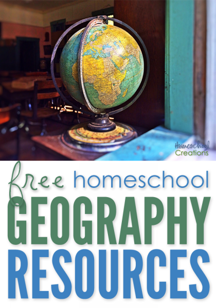
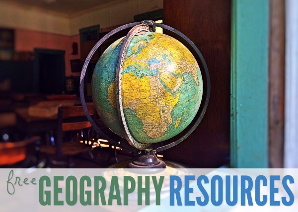
If you are looking for free geography printables to go along with your homeschool studies, below you’ll find several notebooking pages you can use in your home.
Click on one of the globe to search for geography resources by continent. Each page has downloads for flag coloring and information pages, mapping pages and links to blog post full of lesson plans and additional information.


Here’s a quick look at a few more free geography printables to help you out.
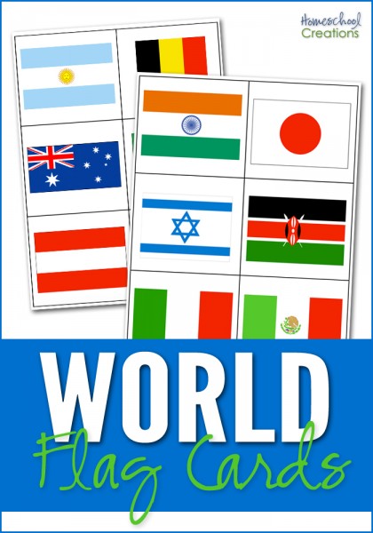
World Flag Cards ~ The world flag cards represent 35 countries based on the countries that are studied in Galloping the Globe {with a few extras thrown in}. The set also contains 6 cards that represent 6 of the 7 continents {Antarctica is excluded} so cards can also be sorted by the continent the country flag belongs to. Country name cards are also included for your child to match the names of the countries with the appropriate flag. Also includes a key at the end of the document to help double check your answers.
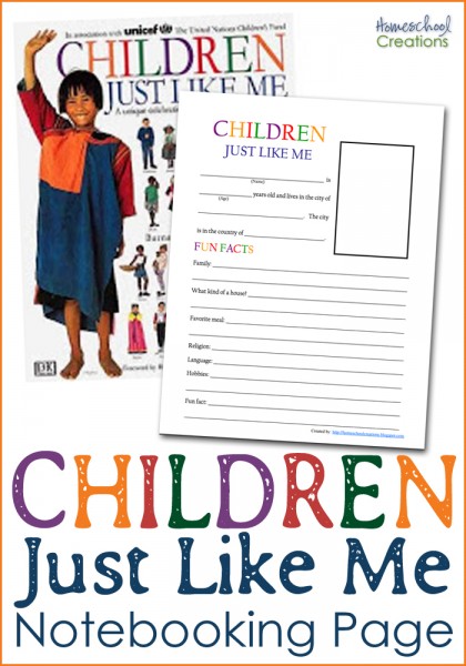
Children Just Like Me Notebooking Page ~ This notebooking page was created to go along with the book Children Just Like Me. Your child collects all the information for the notebooking sheet from the children’s stories in the book. You can read more about the page here.
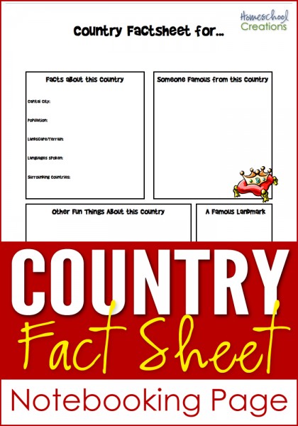
Country Fact Notebooking Page ~ This notebooking sheet can be used for any country. There is room to record information about the country: country facts, famous people, landmark(s), and other fun information. Also room to draw pictures, add clip art and journal. You can see an example here.
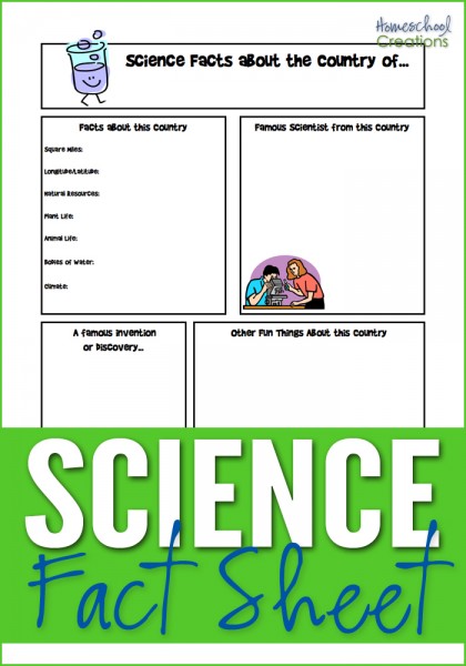
Science Fact Notebooking Page ~ Similar in layout to the Country Fact Notebooking Page, this has room for famous inventors and inventions, science facts about the country, plant and animal life, etc…
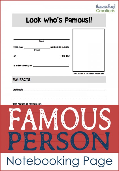
Famous Person Notebooking Page ~ Have a famous person that lived in the country you are studying? This is a notebooking sheet records information about that person: where s/he lived, hobbies, childhood, and what they are famous for. There’s even a little space to add a picture if you’d like.
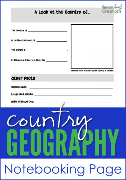
Country Geography Notebooking Page ~ Jot down some notes on the country you are studying: square miles, longitude/latitude, natural resources, religions, languages and more. It also has space to add a picture of the country you are learning more about.
And if you’re looking for more geography fun, you can take a virtual adventure with Little Passports ~ all you have to do is walk to your mailbox to start. :)

Hope that a few of these resources help you all out!

 The printables shared on this site are FREE of charge unless otherwise noted, and you are welcome to download them for your personal and/or classroom use only. However, free or purchased printables are NOT to be reproduced, hosted, sold, shared, or stored on any other website or electronic retrieval system (such as Scribd or Google docs). My printables are copyright protected and I appreciate your help in keeping them that way.
If you download and use some of my printables and then blog about them, please provide a link back to my blog and let me know - I'd love to see how you are using them! Please be sure to link to the blog post or web page and not directly to the file itself. Thank you!
The printables shared on this site are FREE of charge unless otherwise noted, and you are welcome to download them for your personal and/or classroom use only. However, free or purchased printables are NOT to be reproduced, hosted, sold, shared, or stored on any other website or electronic retrieval system (such as Scribd or Google docs). My printables are copyright protected and I appreciate your help in keeping them that way.
If you download and use some of my printables and then blog about them, please provide a link back to my blog and let me know - I'd love to see how you are using them! Please be sure to link to the blog post or web page and not directly to the file itself. Thank you!
You are so talented and generous. Thank you for sharing.
Also, if you and your readers are not aware of it, about half way down the following post is a link to a free Montessori geography album courtesy of Karen Tyler. It is a terrific reosurce – http://www.ourjourneythruautism.com/2011/02/worldwide-montessori-online-course.html
The funny thing is I was just looked through your geography stuff to find a good printable to use for learning about explorers. The one that came with the curriculum there was no chance my kids could write that small…….
I loves these pages and share them with many of my friends who sponsor through Compassion International. Thank you so much for making these available!!
Thanks! Awesome :)
How wonderful we are just starting with little passports and working on Brazil right now. I will be using your work sheets Thank you for sharing. We are busy planning our Brazilian meal today:) that we plan to cook this weekend Feijoada stew and Brigaderiros cookies:)
TThank you for these wonderful printables! They will be so perfect for our studies this year, as we explore countries and cultures!
Thank you for the geography resources. I have posted and linked to them on my blog at http://www.heartsforhomeschooling.blogspot.com. The post will post on 08/11/2011.
Mrs.Hearts
Thanks for reminding me about these! We are doing world geography this year with MFW!
haha!! :)
Just wanted to thank you again for sharing all of your resources! My son put on his Cubbies vest when he got dressed this morning and brought out his book. He asked if I knew what superhero he was and what his power is. His statement, “I’m Cubbie Boy and I teach people that don’t know God all about Him!” He wants to be a prohpet when he grows up. No point making him wait, right?
I looked at your Cubbie printables and we may use them in a photo book like you suggested, thanks!
that is GREAT!!! :)
Hi from Germany :)
I enjoy your creations, and I try to adapt them as much as possible for working with my own kids, so, thatnk you very much :)
Just one issue:
In your Canada unit, you stated that Canada is the world´s largest country – it isn´t, Russia is almost twice as large – source:
https://www.cia.gov/library/publications/the-world-factbook/rankorder/2147rank.html?countryName=Canada&countryCode=ca®ionCode=noa&rank=2#ca
However, I don´t want to appear annoying, I just thought that you´d like your material to be as correct as possible. And if you´d like to improve your German-unit – feel free to write me, I have lots of ideas :)
It appears that some of the text was cut off in the post. Here is what the lesson plans posted here actually say:
http://homeschoolcreations.blogspot.com/2010/10/o-canada-lesson-plans-and-resources.html
Canada spans more than half of the Northern Hemisphere and *is the second largest country in the world*. It also has the world’s longest coastline ~ there are oceans on three sides. Canada’s lakes and rivers make up about 20% of the world’s fresh water.
The population of Canada is less than half a percent of the world’s population. The majority of Canada’s people live in the southern part of Canada and the largest cities are Montreal, Toronto and Vancouver. Canada’s two official languages are French and English.
Thanks for showing me that the text was cut off. :)
Thanks, many interesting links. Another great homeschool tool for learning geography is Seterra Online, an online HTML5 world geography game. http://online.seterra.net/en/
This is wonderful! Thanks so much for sharing.
Love the geography ideas. I’m for sure going to use the ‘Look Who’s Famous’ page! Thanks.
You are welcome, April! Enjoy!